Colorado State University Tropical Weather and Climate Research

Research

TC Intensity

Check the publication list of the related research

How does CD influence TC intensification?

Figure

Group Members: Eleanor Casas , Michael M. Bell

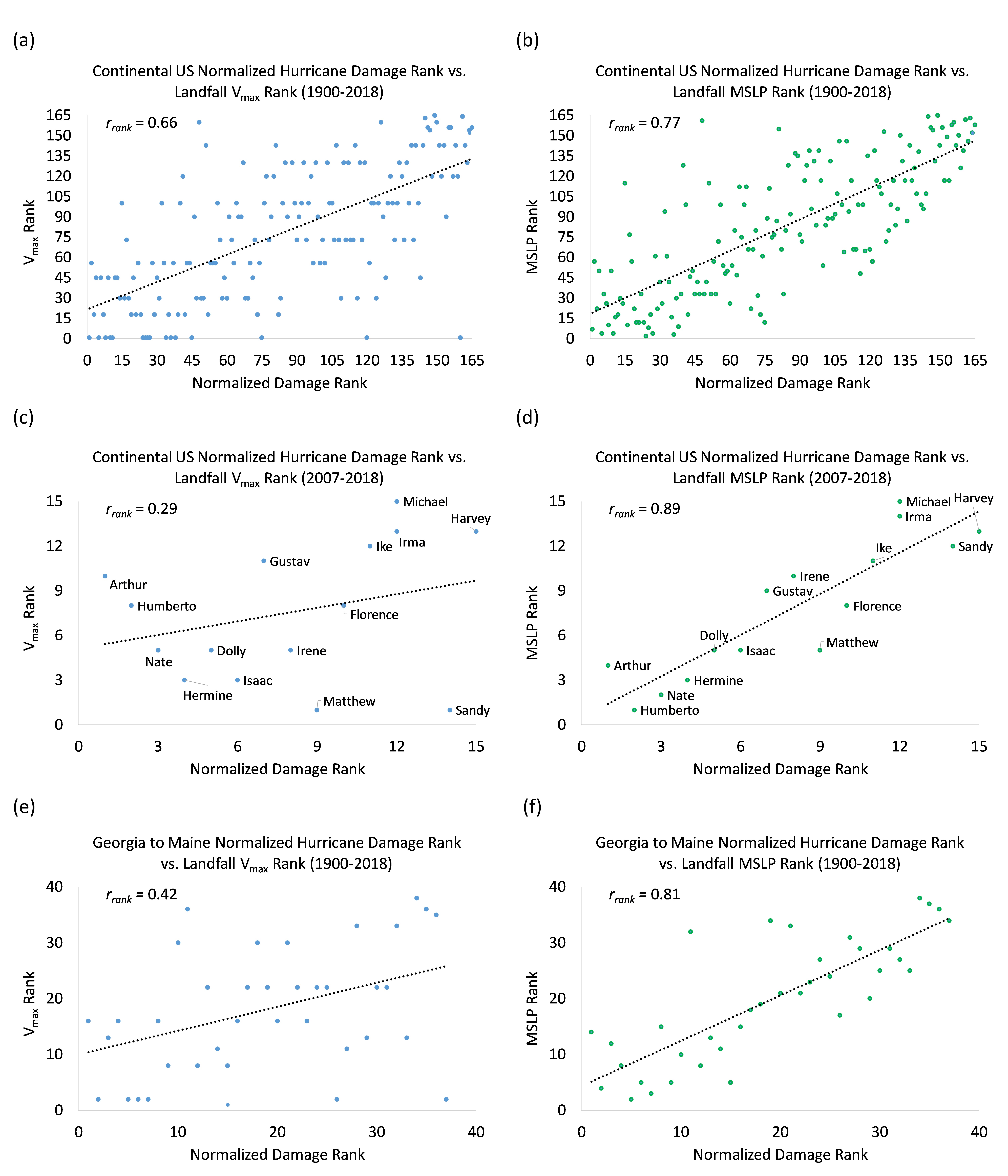
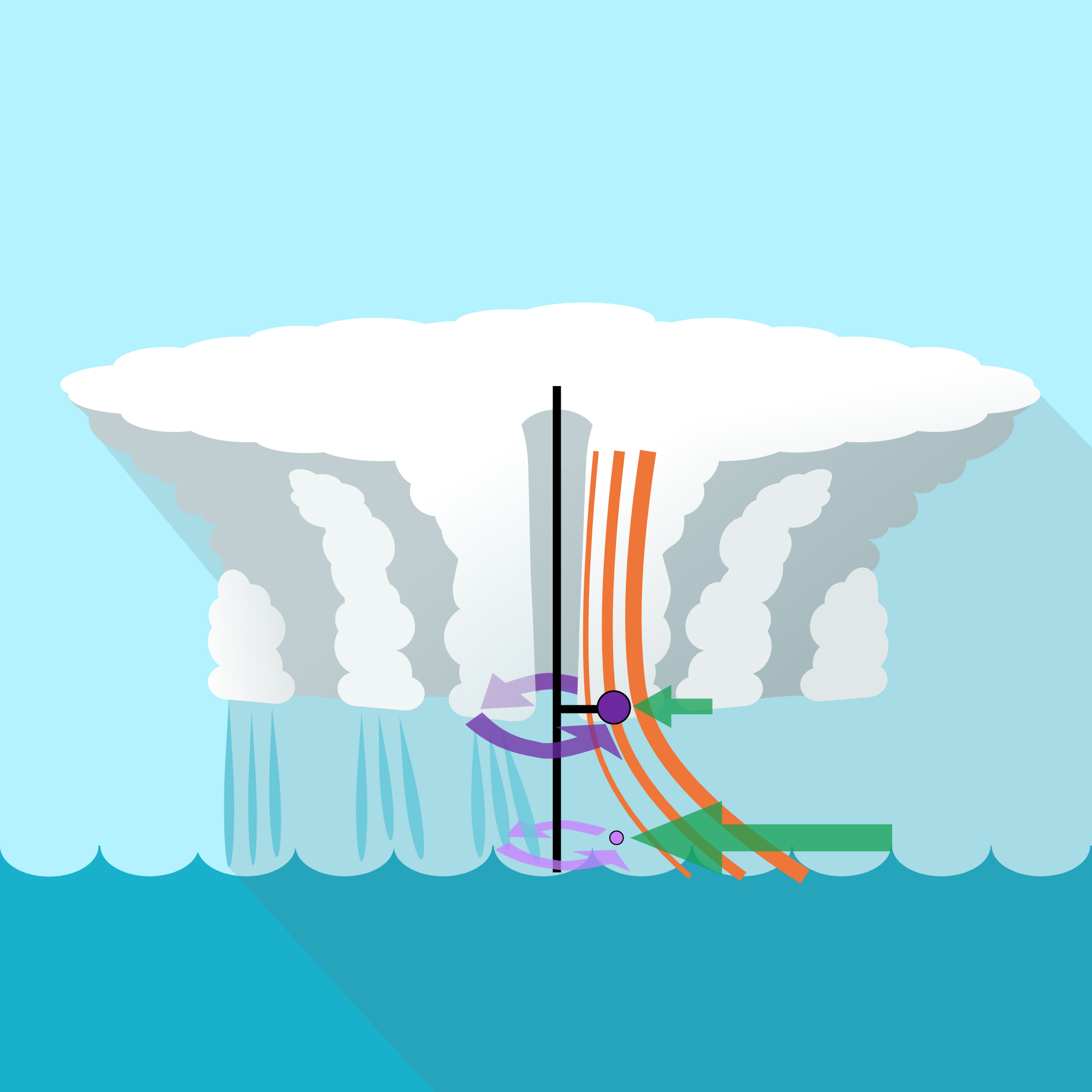
We developed a new, simplified conceptual model that relates TC boundary layer structural quantities---the maximum tangential wind, its radius, its height, its underlying vertical gradient, and its underlying drag coefficient---to the TC’s potential for further intensification. In addition, the new conceptual model is also able to be inverted and be used to retrieve values of interest, namely the drag coefficient under the maximum tangential wind.


How do maximum sustained wind and minimum sea level pressure relate to normalized damage?

Figure

Group Members: Philip J. Klotzbach , Michael M. Bell

Atlantic hurricanes have historically been categorized using the Saffir-Simpson Hurricane Wind Scale, which ranks hurricanes based on their maximum sustained wind (e.g., Vmax). In this study, we investigate whether Vmax or minimum sea level pressure (MSLP) historically has worked as a better predictor of continental US hurricane landfall damage. We use the normalized hurricane damage dataset from Weinkle et al. (2018) and show that MSLP (r = 0.77) has a more significant correlation with damage than has Vmax (r = 0.66) for 165 continental US landfalling hurricane events since 1900 (Figure 7). The relationship has been much stronger for MSLP in recent years, where recent hurricanes like Ike (2008) and Sandy (2012) have done much more damage than would have been expected from their Saffir-Simpson Hurricane Wind Scale ranking. MSLP has also been a much better predictor of damage for hurricanes making landfall from Georgia to Maine, where hurricanes tend to be larger and more sprawling.